Discover the best routes up Snowdon with expert advice from a qualified Mountain Leader. Compare paths, plan your hike, and book a guided adventure today.
What is the Best Route Up Snowdon?
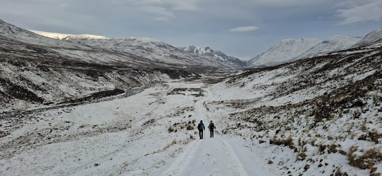
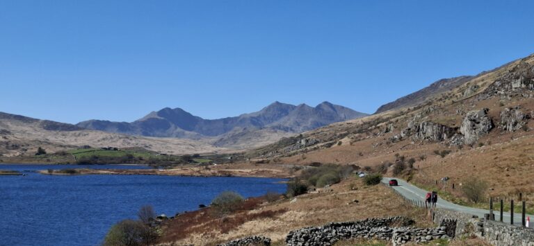
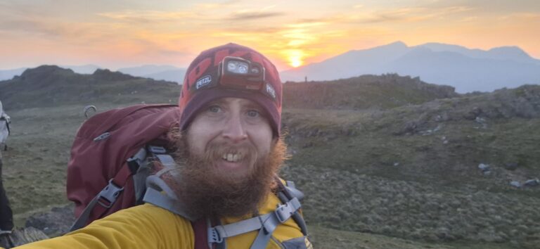
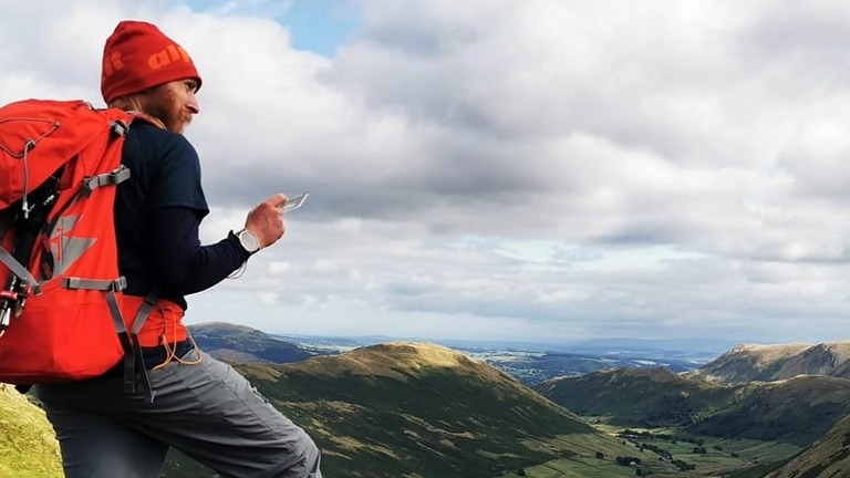
As a qualified Mountain Leader, I am often asked for advice on the best route up Snowdon. I’ve personally walked each of the routes described in this guide—plus a few off the beaten track hidden gems, which I love to share with clients. I call on this experience to inform my advice, depending on what my clients want to get out of the day.
Whether you’re aiming for your first summit or tackling a more adventurous scramble, this guide will help you choose the best route for your day. And if you’d like expert support to make your experience safer, smoother, and more memorable, I would be delighted to guide you.
Route Comparison Table
| Route | Start Point | Length (miles/km) | Elevation (ft/m) | Estimated Time | Difficulty | Popularity | Best For | Views Rating |
| Llanberis Path | Llanberis | 11 miles / 18 km | 3,250 ft / 990 m | 7-9 hours | Easiest | High | Beginners, families | Low |
| Pyg Track | Pen-y-Pass | 7 miles / 11 km | 2,750 ft / 840 m | 4-6 hours | Moderate | High | Classic, scenic, efficient | High |
| Miners’ Track | Pen-y-Pass | 8.5 miles / 14 km | 2,600 ft / 790 m | 6-8 hours | Moderate | High | Scenic descent, lakeside views | High |
| Watkin Path | Nant Gwynant | 8 miles / 13 km | 3,500 ft / 1,100 m | 6-8 hours | Hard | Medium | Challenge + scenery | Very High |
| Rhyd Ddu Path | Rhyd Ddu | 7.5 miles / 12 km | 3,000 ft / 920 m | 5-7 hours | Moderate | Low | Quiet, rugged, scenic | High |
| Snowdon Ranger Path | Snowdon Ranger | 8 miles / 13 km | 3,100 ft / 945 m | 6-8 hours | Moderate | Medium | Quieter alternative | Medium |
| Crib Goch | Pen-y-Pass | 6.5 miles / 10.5 km | 3,700 ft / 1,100 m | 6-8 hours | Very Hard | High | Scramblers, thrill-seekers | Very High |
| Y Lliwedd | Pen-y-Pass | 8.5 miles / 14 km | 4,100 ft / 1,250 m | 7-9 hours | Hard | Low | Panoramic views, quieter | High |
Your message has been sent

Detailed Route Descriptions
Llanberis Path – The Tourist One
| Start Point | Llanberis – Plenty of parking and shops. Do be respectful if starting early though, you might be excited to be climbing Snowdon at 4am, but the locals are probably still trying to sleep! |
| Length | 11 miles / 18km |
| Elevation | 3250ft / 990m |
| Time | 7-9 hours |
| Difficulty | This is the least difficult route. It has the best track, is waymarked and is a steady climb all the way up. Least difficult doesn’t mean easy though! |
| Popularity | This is the most popular route; Expect to be walking with crowds of other folk, regardless of the time of day or prevailing weather. |
Pyg Track – The Quick One
| Start Point | Pen-y-Pass – This carpark sits at the top of the valley, meaning you’re already 360m up the mountain when you step out of the car. This convenience comes at a price, and you’ll need to pre-book your parking well in advance. There are toilets operated by the National Park. |
| Length | 7 miles / 11km |
| Elevation | 2750ft / 840m |
| Time | 4-6 hours |
| Difficulty | While this route has less elevation than the Llanberis path, the climbing is also packed into a shorter route, so it is a bit tougher. While easy to follow, the track is also a bit rougher, so that might factor into your decision. |
| Popularity | The Pyg track is only marginally less travelled than the Llanberis path, but given the narrower path, it will still feel busy! Given this is the quickest path to the summit, it’s also the one most people use when completing the National Three Peaks. |
Planning to take on Snowdon as part of a Three Peaks Challenge? I can help you bring your challenge to life, from making sure you’re training is on track, to logistics between the mountains, and ensuring everyone gets up and down safely on the day – get in touch to start planning!
Miners Track – The Picturesque One
| Start Point | Pen-y-Pass – This carpark sits at the top of the valley, meaning you’re already 360m up the mountain when you step out of the car. This convenience comes at a price, and you’ll need to pre-book your parking well in advance. There are toilets operated by the National Park. |
| Length | 8.5 miles / 14km |
| Elevation | 2600ft / 790m |
| Time | 6-8 hours |
| Difficulty | While the Pyg Track heads steadily upwards from the carpark, the Miners Track first takes a lower-level route along the shore of Llyn Llydaw. This means the ascent comes in a shorter sharper shock around 2 miles into the route. |
| Popularity | The Miners Track is on par with the Pyg Track for popularity; The have much in common in terms of start point, scenery and difficulty. The picturesque shoreside walk adds a little variety to the route at the expense of a steeper climb. |
Watkin Path – The Tough One
| Start Point | Bethania – There is a carpark with toilets, and a café a short walk up the road. |
| Length | 8 miles / 13km |
| Elevation | 3500 ft / 1100m |
| Time | 6-8 hours |
| Difficulty | The Watkin Path has the most elevation gain out of all the routes here, making it a strenuous day out. The track gets loose towards the top of the mountain, while not quite technical enough to be a graded scramble, you’ll likely need to use your hands in places to haul yourself up some of the bigger steps. |
| Popularity | The routes from the south of the mountain are far less popular than those coming from the Llanberis pass. That’s not to say they are any less worthwhile considering, in fact the views across south Snowdonia are stunning and getting away from the crowds is certainly why many people choose this route. |
Looking to get the authentic mountain experience while climbing Snowdon? There’s more to a day in the mountains than getting to the summit. Join me for the day and I can bring the mountain to life as we immerse ourselves in the nature, history and legends that we encounter on our journey.
Rhyd-Ddu – The Secret One
| Start Point | Rhyd-Ddu – Theres a carpark with toilets, and a pub further down the road in the village. |
| Length | 7.5 miles / 12km |
| Elevation | 3000 ft / 920m |
| Time | 5-7 hours |
| Difficulty | Sitting between the Pyg Track and Watkins Path in terms of difficulty, the Rhyd-Ddu paths is mostly well defined with short sections that require the hands to get up steep steps. There’s a small amount of exposure on the South Ridge, but nothing to be overly concerned about, and plenty of space to avoid the craggy ground. |
| Popularity | Much like the Snowdon Ranger, the Rhyd-Ddu is an underrated secret gem! You’re unlikely to meet many people until the last few hundred metres, where the track meets the Watkins Path, and then emerges onto the summit. |
Snowdon Ranger – The Tranquil One
| Start Point | Llyn Cwellyn car park – There’s a carpark but not much else in the way of facilities. |
| Length | 8 miles / 13km |
| Elevation | 3100 ft / 945m |
| Time | 6-8 hours |
| Difficulty | The Ranger path is on par with the Llanberis Path, being a well laid track in the most part and a steady climb all the way up. |
| Popularity | In stark contrast to the Llanberis Path, the only people you’re likely to meet on the Snowdon Ranger are the ones queuing for a selfie at the summit. The lack of facilities at the start probably explains this, but plan your day well, and you’ll reap the rewards of a tranquil hike against the backdrop of natural beauty that the rest of Snowdonia offers! |
Crib Goch – The Thrillseeker One
| Start Point | Pen-y-Pass – This carpark sits at the top of the valley, meaning you’re already 360m up the mountain when you step out of the car. This convenience comes at a price, and you’ll need to pre-book your parking well in advance. There are toilets operated by the National Park. |
| Length | 6.5 miles / 10.5km |
| Elevation | 3700 ft / 1100m |
| Time | 6-8 Hours |
| Difficulty | Not for the faint of heart, Crib Goch is a classic Grade 1 Scramble. The main event is the 1-mile knife-edge ridge, traversing from the summit of Crib Goch across to Garnedd Ugain. Couple this with the fact these two summits complete the trio of Welsh 3000’s on the Snowdon Mastiff, you’ll be ascending two mountains before you even think about claiming Snowdon. Only take on this route if you have a good head for heights and the fitness required to complete the route, as once you’re on the ridge, there’s no escape route other than going back the way you came. |
| Popularity | While this is the toughest route up to the summit of Snowdon, the challenge is a draw to adrenaline seekers and makes this one of the most popular grade 1 scrambles in the UK. This means it gets busy on weekends and holidays, which can add to the challenge as passing places are few and far between. |
Not sure if this route is right for you? I offer guided scrambles for individuals and small groups—get in touch to learn more.
Y Lliwedd – The Unusual One
| Start Point | Pen-y-Pass – This carpark sits at the top of the valley, meaning you’re already 360m up the mountain when you step out of the car. This convenience comes at a price, and you’ll need to pre-book your parking well in advance. There are toilets operated by the National Park. |
| Length | 8.5 miles / 14km |
| Elevation | 4100 ft / 1250m |
| Time | 7-9 Hours |
| Difficulty | Also offering a grade 1 scramble, Y Lliwedd is best tackled in clear weather by those with the nerves and fitness to spend a day in difficult terrain. Slightly less exposed than the Crib Goch ridge, it’s a nice alternative for those wanting a hit of adrenaline with slightly less risk. |
| Popularity | Less popular than Crib Goch, Y Lliwedd offers a respite from the crowds on the other routes starting from Pen-y-Pass with a healthy dose of excitement and all the views. |
Circular Route Options
Do I have to return the way I came, or can I make any of these into a circular?
The beauty of having several choices of routes starting from every side of the mountain, means we combine the routes to add a bit of variety to the day.
All the routes starting from Pen-y-Pass can be combined to ascend and descend via different routes without needing to worry about getting back to the car.
Going up via the Pyg and down via the Miners is a common choice.
It’s not recommended to descend Crib Goch, so this too is often coupled with a descent of the Miners or Pyg Track. Another choice is to complete the Snowdon Horseshoe, ascending Crib Goch and descending Y Lliwedd, making for an enjoyable day of Scrambling!
It’s possible to link up the Rhyd-Ddu and Snowdon Rangers Paths, either catching the Welsh Highland Railway back to the car or walking the 3 miles of so back along the road.
The Snowdon Sherpa bus service also gives the choice of completing a linear walk over the mountain, without the need to descend via a path that leads back to the start.
This means climbing the Rhyd-Ddu, Ranger or Watkins path and descending the Llanberis Path is feasible, giving a nice balance of starting the day with a quieter, more interesting ascent with an easier descent that ends with a good range of facilities in Llanberis.
There are also options to head down the South Ridge to make the Watkins path a circular or heading part way down the Rangers Path before continuing along the ridgeline towards Moel Eilio to make the Llanberis path an interesting (if long) day out in the hills.
There are several alternative scrambling routes up onto Yr Wyddfa, if you want the thrill of Crib Goch while avoiding the crowds at Pen-y-Pass. These allow you to experience “The Mountain” in all it’s natural beauty, offering everything from an easy grade one spur through to a classic grade three arete.
Whether you’re planning your first ascent or looking to tackle one of Snowdon’s more adventurous routes, I’d love to help you make it a safe and unforgettable experience. Click here to get in touch or book a guided hike.
Planning Tips for Climbing Snowdon
So, which one should I choose?
Aside from picking the route that best matches the difficulty and challenge you’re looking to take on, there are a few other considerations that go into planning for a great day out in the mountains:
- Weather – The weather catches thousands of people out on Snowdon each year and should not be underestimated! Rain and high winds can make many of the “challenging” routes treacherous, while wall-to-wall sunshine can quickly zap your energy on a long mountain day. We’d recommend checking a few forecasts in the days running up to your planned adventure, such as the Met Office Mountain Forecast and Mountain Weather Information Service, and remember, a warm sunny day in the bottom of the valley could well be very cold and windy at the top of the mountain!
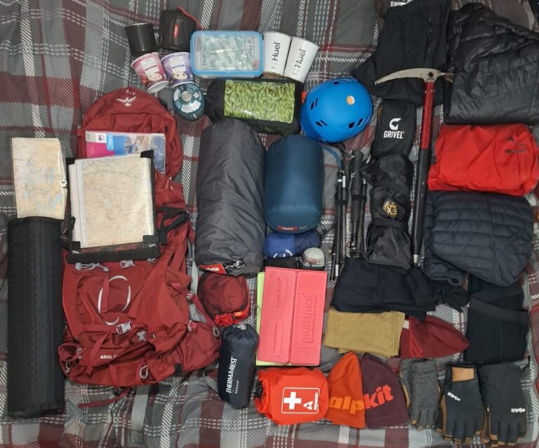
- Equipment – Pack essentials like a map, compass, waterproof jacket and trousers, extra layers of warm clothing, sufficient food and water, and a first-aid kit. Consider sun protection (hat and sunscreen) or cold-weather gear (warm hat and gloves) depending on the weather forecast. If in doubt, reach out to us and we’ll be happy to advise on essential equipment we’d recommend carrying on one of our events (or check out this post, to see what we pack in our huge rucksack!)
- Emergency Preparedness – Always inform someone of your plans, including route and expected return time. Know how to use your phone to contact emergency services if needed and have a backup plan if your phone fails. Mobile phones have become a swiss army knife of features now, offering navigation, weather updates and cameras that can capture the views in exquisit detail; But these all come at a price for battery life, so it’s wise to keep at least one phone in the group for emergency use only, and potentailly using other devices for these other activities. It’s also worth signing up for the EmergencySMS service before you head into the mountains, as often signal can be poor, and getting a text message out where a voicecall cannot be supported might just be the difference between getting help and not.
- Route Planning and Navigation – while most of these paths are relatively easy to follow in isolation, there are many tracks and paths crisscrossing the mountain at various points, not least the summit where there are no less than 8 paths converging on each other. The last thing you want is to pick up the wrong path and end up on the wrong side of the mountain at the end of a long day, so make sure you know where you set off from, and the route you plan to take back down. Basic map and compass skills will go a long way to mitigating this risk. Why not incorporate some navigation skills training into your day out?
- Facilities – If you’re planning a family trip up Snowdon, facilities like toilets and shops will likely feature higher on your priority list. Llanberis and Pen-y-Pass are your best choice here, but with a bit or pre-planning the routes from the south are excellent choices too. Whichever route you choose, remember to be mindful of the environment, and pack out everything you pack in, following the “Leave No Trace” principles.
- Fitness, Experience and Group Dynamics – Ensure the chosen route is appropriate for the fitness and experience of all participants. Plan with your group and discuss any potential challenges or concerns. It’s all too easy to get caught up in the excitement of going for an adventure together, and find one or more of the group are out of their depth part way through the day. This will inevitably lead to a long and uncomfortable day for the group, but can quickly escalate to group members becoming seperated and getting lost, excess fatigue leading to poor decision making, and exhaustion resulting in slips, trips and falls on tired legs – all of which will turn a great day out into a nightmare.
Book a Guided Hike
You can reach me via:
Email: P600Mountaineering@outlook.com
Instagram: @P600Mountaineering
Or leave a message below: